
177件中 1~10件目を表示中 (日付順)
査読付論文

International Journal of Applied Earth Observation and Geoinformation所収
Quantitative monitoring of lake water storage in arid regions is essential for effective management of regional water resources, and can also elucidate the impacts of ecological degradation on lake water storage. This study investigates changes in water storage in Ebinur Lake, Xinjiang, from 2011 to 2024 using field–measured water depth data and...
査読付論文

Sustainability Science所収
Accelerating urban population concentration across the world has both positive and negative social-ecological consequences. Countries facing serious negative consequences like Japan need to explore enhanced deurbanization pathways, e.g., highlighting high quality of life in rural areas, to achieve a more desirable urban-rural population balance...
査読付論文
IEEE Journal of Selected Topics in Applied Earth Observations and Remote Sensing所収
Lakes play a crucial role in supplying water resources, regulating regional climates, and supporting ecosystems. However, they are increasingly threatened by recurrent droughts. This study focuses on the Mu Us Sandy Land, the fourth largest desert in China, and presents an approach that combines machine-learning techniques with a newly constructed...
コンファレンスペーパー
Asia Conference on Environment and Sustainable Development
National‐scale monitoring of mangrove forests, including their spatial structure (e.g., canopy height and above‐ground biomass), is necessary for the implementation of global agreements related to climate change and biodiversity conservation. Field measurements of mangrove structural parameters, however, are costly to collect. Here, we investigated...
ブックチャプター
Environment and Sustainable Development: Proceedings of the 2024 9th Asia Conference on Environment and Sustainable Development所収
In this study, we developed a logistic regression modeling approach to analyze the relationship between utility-scale solar power plant (SPP) locations and flood hazards. Based on the standardized coefficients of the model, we compared this relationship with the relationship between SPP presence/absence and other typical spatial determinants like...
査読付論文
Remote Sensing所収
Over the last decade, L-band synthetic aperture radar (SAR) satellite data has become more widely available globally, providing new opportunities for biodiversity and ecosystem services (BES) monitoring. To better understand these opportunities, we conducted a systematic scoping review of articles that utilized L-band synthetic aperture radar (SAR)...
査読付論文
Energy for Sustainable Development所収
Solar energy systems, either land- or water-based, have a huge potential for net-zero transition and generate multiple co-benefits despite the possible risks of not being designed or installed properly. Existing literature has revealed both positive and negative impacts of solar photovoltaic (PV) from the viewpoints of engineering design, energy...
委託報告書
2024年度、国立研究開発法人宇宙航空研究開発機構(JAXA)が有する衛星技術・データ・知見の国際環境政策への活用を促進するため、以下の業務を行った。本作業報告書では、これら活動の作業概要について報告する。 パリ協定における国家の温室効果ガス排出報告のための ALOS データの事例調査を活用したトレーニングの実施支援 昆明・モントリオール生物多様性枠組(GBF)モニタリング・フレームワーク調査
査読付論文
Catena所収
Net primary productivity (NPP) reflects the carbon sequestration capacity of terrestrial ecosystems, serving as a crucial indicator of ecosystem health. Arid and semiarid regions, which are ecologically fragile, respond strongly to climate change and human activities, necessitating adequate NPP monitoring. However, large-scale NPP studies for...
査読付論文
Remote Sensing所収
Land use/cover change (LUCC) significantly alters the carbon storage capacity of ecosystems with a profound impact on global climate change. The influence of land use changes on carbon storage capacity and the projection of future carbon stock changes under different scenarios are essential for achieving carbon peak and neutrality goals. This study...
2件中 1~2件目を表示中 (日付順)
プロジェクト

Updated: 2025年3月
環境研究総合推進費1CN-2206(2022~2024年度) ASEANにおけるネットゼロかつレジリエントな社会実現に向けた国家の緩和適応統合長期ロードマップに関する研究
IGESでは、ASEAN気候ビジョン2050が示すネットゼロかつレジリエントなASEAN共同体の構築に向けて、ASEAN主要4カ国(インドネシア、フィリピン、タイ、ベトナム)を対象とする、緩和・適応を統合的に推進する長期ロードマップ策定に関する研究を実施しています(環境研究総合推進費1CN-2206:2022年4月~2025年3月)。 本研究事業の成果は、国家の長期戦略(LTS)、国が決定する貢献(NDC)、国家適応計画(NAP)、セクター別計画、開発計画等をはじめ...
プロジェクト
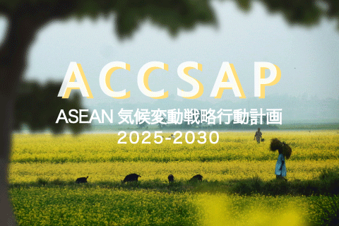
Updated: 2026年7月
ASEAN気候変動戦略行動計画 2025-2030プロジェクト
ASEAN気候変動戦略行動計画(The ASEAN Climate Change Strategic Action Plan:ACCSAP)2025-2030は、2030年までの、ASEANにおける気候変動ロードマップです。 IGESは、2021年にASEAN地域の気候変動の状況を、はじめて統合的にまとめたレポートととして「ASEAN State of Climate Change Report(ASCCR)」の作成に貢献しました。ACCSAPはこのASCCRで特定された優先順位の高い行動を...