

177件中 131~140件目を表示中 (日付順)
査読付論文
Land所収
This study uses a spatially-explicit land-use/land-cover (LULC) modeling approach to model and map the future (2016–2030) LULC of the area surrounding the Laguna de Bay of Philippines under three different scenarios: ‘business-as-usual’, ‘compact development’, and ‘high sprawl’ scenarios. The Laguna de Bay is the largest lake in the Philippines and...
査読付論文

Computers, Environment and Urban Systems所収
Land cover change (LCC) can have a significant impact on human and environmental well-being. LCC maps derived from historical remote sensing (RS) images are often used to evaluate the impacts of past LC changes and to construct models to predict future LC changes. Free moderate spatial resolution (~30 m) optical and synthetic aperture radar (SAR)...
委託報告書
REDD+の効果的な実施に向けた具体的な方策を示すため、REDD+の国際的な制度の動向等について多角的に調査・分析を行い、得られた結果について体系的に整理した。1-1ではUNFCCCを中心とした国際的な議論の動向について取りまとめた。1-2では、既存のクレジット制度である京都メカニズムの共同実施に注目した。1-3では、現在進んでいるREDD+に係る資金拠出に係る取組状況として、緑の気候基金、世界銀行の森林炭素パートナーシップ基金、The REDD+ Early Movers Programについて調査した。1-4では、REDD+に関する政策的な検討や各国の緩和対策の中での位置付けとREDD+活動の実施状況を、JCMパートナー国5カ国(インドネシア、ベトナム、カンボジア、ラオス、コスタリカ...
ファクトシート
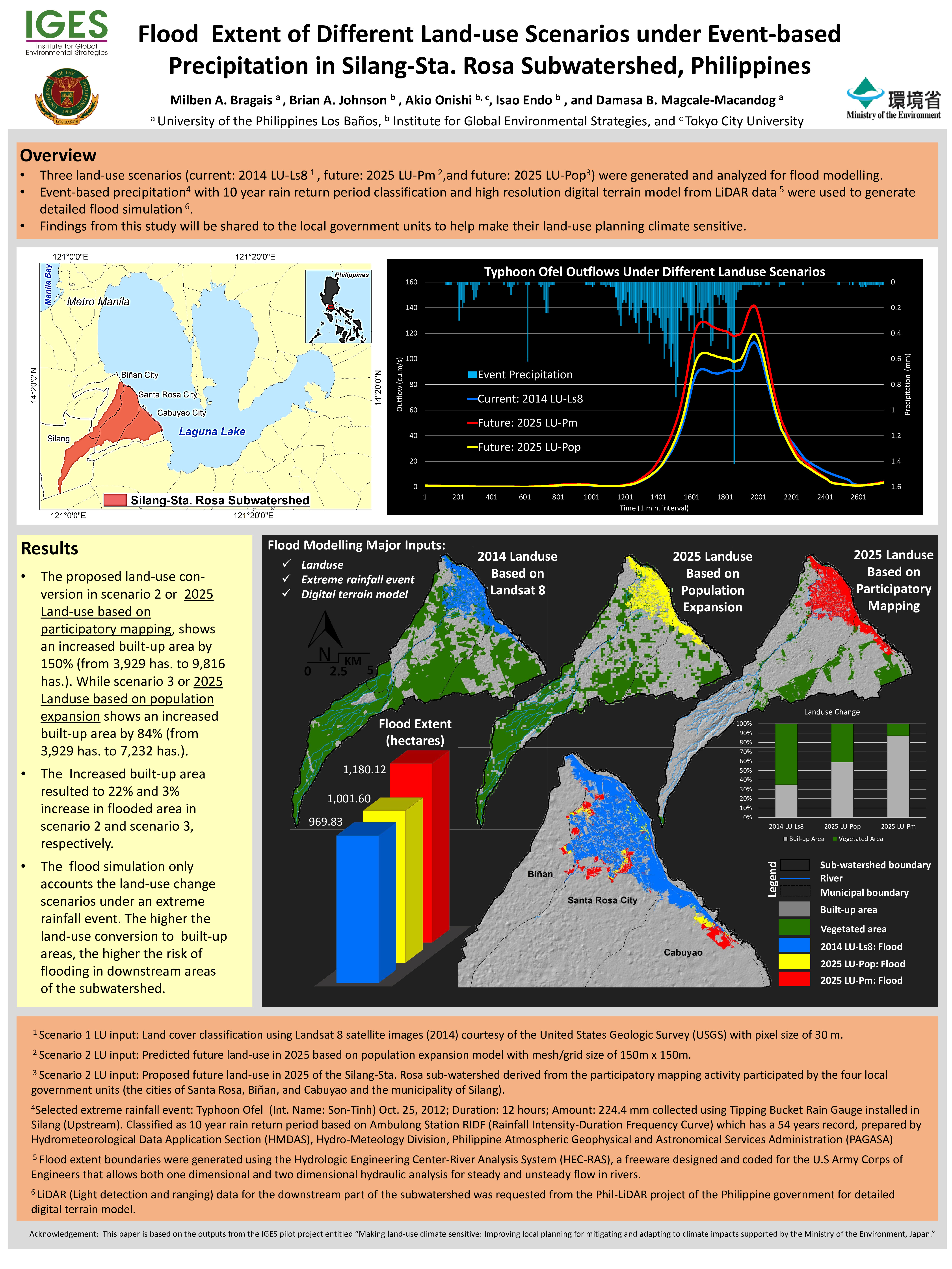
Three land-use scenarios (current: 2014 LU-Ls8, future: 2025 LU-Pm, and future: 2025 LU-Pop) were generated and analyzed for flood modelling. Event-based precipitation with 10 year rain return period classification and high resolution digital terrain model from LiDAR data5were used to generate detailed flood simulation. Findings from this study...
ファクトシート
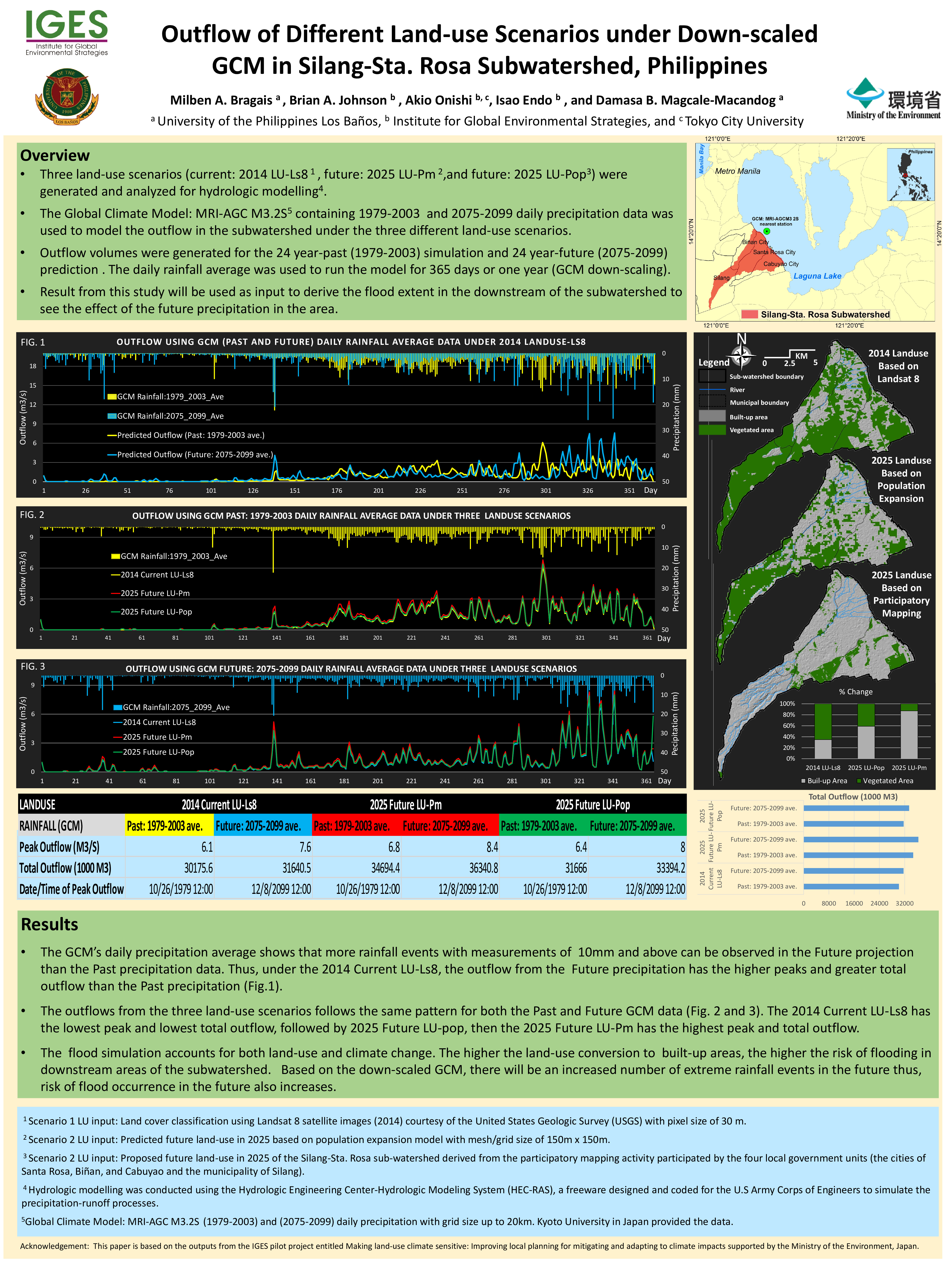
Three land-use scenarios (current: 2014 LU-Ls8, future: 2025 LU-Pm, and future: 2025 LU-Pop) were generated and analyzed for hydrologic modelling. The Global Climate Model: MRI-AGC M3.2S5containing 1979-2003 and 2075-2099 daily precipitation data was used to model the outflow in the subwatershedunder the three different land-use scenarios. Outflow...
コンファレンスペーパー
The Silang-Sta. Rosa subwatershed has undergone massive land use changes in the past two decades, brought about by rapid urbanisation and industrialisation. Since it is ideally strategically located for economic development, further conversion of forest and agricultural land for industrial, residential and commercial activities is planned in the...
コンファレンスペーパー
In this study, we assessed the relationship between land cover change and changes in water quality in the Laguna de Bay area of the Philippines. Land cover changes occurring between 2007 and 2015 were mapped using a combination of optical (Landsat-7/-8) and synthetic aperture radar (ALOS Palsar-1/-2) satellite imagery, and time-series water quality...
データ/ツール
This dataset contains supplementary material for the journal paper by Johnson et al. (2017). In the paper, OpenStreetMap crowdsourced data was used in combination with different types of satellite imagery to identify and map land cover changes in the Laguna de Bay area of the Philippines. The dataset provides the training data (derived from the...
査読付論文
The International Archives of the Photogrammetry, Remote Sensing and Spatial Information Sciences所収
Developing countries must submit forest reference emission levels (FRELs) to the UNFCCC to receive incentives for REDD+ activities (e.g. reducing emissions from deforestation/forest degradation, sustainable management of forests, forest carbon stock conservation/enhancement). These FRELs are generated based on historical CO2 emissions in the land...
査読付論文
Journal of Applied Remote Sensing所収
Multiresolution segmentation and rule-based classification techniques are used to classify objects from very high-resolution satellite images of urban areas. The major contribution of this research is the development of rule sets and the identification of major features for satellite image classification where the rule sets are transferable and the...
2件中 1~2件目を表示中 (日付順)
プロジェクト

Updated: 2025年3月
環境研究総合推進費1CN-2206(2022~2024年度) ASEANにおけるネットゼロかつレジリエントな社会実現に向けた国家の緩和適応統合長期ロードマップに関する研究
IGESでは、ASEAN気候ビジョン2050が示すネットゼロかつレジリエントなASEAN共同体の構築に向けて、ASEAN主要4カ国(インドネシア、フィリピン、タイ、ベトナム)を対象とする、緩和・適応を統合的に推進する長期ロードマップ策定に関する研究を実施しています(環境研究総合推進費1CN-2206:2022年4月~2025年3月)。 本研究事業の成果は、国家の長期戦略(LTS)、国が決定する貢献(NDC)、国家適応計画(NAP)、セクター別計画、開発計画等をはじめ...
プロジェクト
Updated: 2026年7月
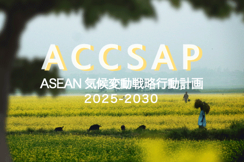
ASEAN気候変動戦略行動計画 2025-2030プロジェクト
ASEAN気候変動戦略行動計画(The ASEAN Climate Change Strategic Action Plan:ACCSAP)2025-2030は、2030年までの、ASEANにおける気候変動ロードマップです。 IGESは、2021年にASEAN地域の気候変動の状況を、はじめて統合的にまとめたレポートととして「ASEAN State of Climate Change Report(ASCCR)」の作成に貢献しました。ACCSAPはこのASCCRで特定された優先順位の高い行動を...