- 日本語
Date: 2024/07/05


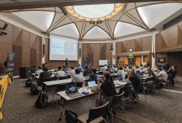
このイベントは、YellowScan Japanが主催するドローン LiDAR技術に焦点を当てたものです 。1日目は、長者ヶ崎でのデモフライトを中心に、Acecore、Freefly Systems、NTT e-Drone、DJI、ACSLなど各社のドローンによるNavigator、Voyager、Explorer、Ultraといった機種の飛行が予定されています 。2日目は、千葉大学の加藤先生によるドローンレーザーを用いた森林計測に関する特別講演や、地球環境戦略研究機関の金研究員による海岸調査に関する講演など、技術セミナーが中心でした 。YellowScan製品の紹介やデータ紹介、質疑応答なども行われました。
This event, hosted by YellowScan Japan, focuses on drone LiDAR technology. The first day features demonstration flights at Choujagaski, showcasing drones from companies like Acecore, Freefly Systems, NTT e-Drone, DJI, and ACSL, with models such as Navigator, Voyager, Explorer, and Ultra. The second day centers on technical seminars, including a special lecture by Professor Kato from Chiba University on forest measurement using drone lasers, and a lecture by Dr. Jin from the Institute for Global Environmental Strategies on coastal surveys. The event also includes YellowScan product introductions, data presentations, and Q&A sessions.
- 日本語
Date: 2024/07/05