10707件中 9041~9050件 (日付順)
持続可能な開発のための2030アジェンダに関するワーキング・グループ (平成27年度 第2回ポスト2015年開発目標(P15A)に関するワーキング・グループ)
LoCARNET 4th Annual Meeting
Remarks: 環境経済・政策学会2015年大会廃棄物・資源循環セッション報告
The 18th Symposium on Environmental Remote Sensing (in Chiba City, Japan)
We developed a fast method for land cover mapping using satellite imagery and crowdsourced geographic data (land use polygon data). The method is less time- and labor-intensive than traditional land cover mapping methods because the crowdsourced data substitutes for training data collected the traditional way (through field survey or visual image...
This dataset can be used by researchers to test different land use/land cover mapping methods using crowdsourced geographic data and Landsat satellite imagery. The study area is the Laguna de Bay area of the Philippines, and the satellite data is from 2014-2015. This dataset will also be available on the "UCI Machine Learning Repository" (https:/...
Strengthening Food Resource and Information Channels for Sustainable Production and Consumption of Food
One of the most significant lifestyle changes with severe environmental and health consequences being witnessed in the developing Asia is in the form of changes in food consumption behaviour of the people. Recognizing the importance of arresting the negative trends early in the stage, the project aims to address the changing food consumption...
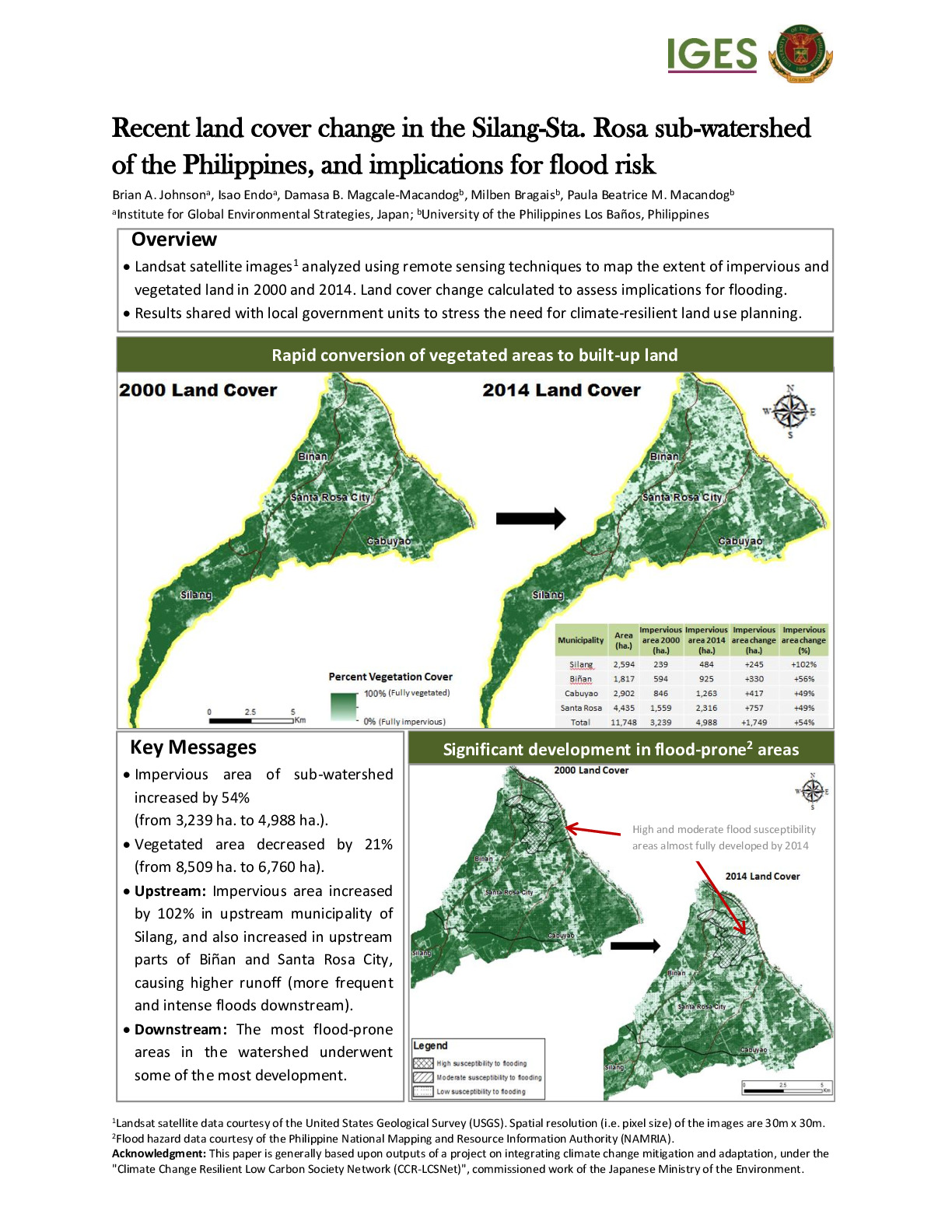
We analyzed the change in vegetated and urban (impervious) area in the Silang-Santa Rosa sub-watershed of the Philippines to assess the implications related to flood risk. Our main findings were: -The impervious area of sub-watershed increased by 54% (from 3,239 ha. to 4,988 ha.). -The vegetated area decreased by 21% (from 8,509 ha. to 6,760 ha)....
