- English
Volume (Issue): 9
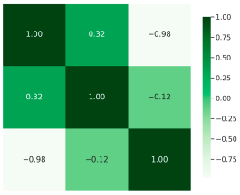


Urban green spaces (UGSs) are vital in enhancing environmental quality, social well-being, and climate resilience, yet their distribution and accessibility remain uneven in many rapidly urbanizing cities. The 3–30–300 rule offers a structured guideline with which to assess urban greenness, emphasizing tree visibility, canopy cover, and green space proximity. However, its applicability in dense and resource-constrained urban environments has not been sufficiently examined. This study evaluates the feasibility of the 3–30–300 rule in Nagpur, India, using survey-based visibility assessments, NDVI-derived vegetation cover analysis, and QGIS-based accessibility evaluation. The study also introduces the Urban Greenness Exposure Index (UGEI), a composite metric that refines greenness assessment by capturing intra-zone variations beyond broad classifications. The findings reveal significant variations in urban greenness exposure across Nagpur’s ten municipal zones. Low-greenness zones report the highest tree visibility deprivation (below two trees), limited canopy cover (~7%), and restricted green space access (over 80% of residents lacking access within 300 m). The correlation analysis shows that higher canopy cover does not necessarily correspond to better visibility or accessibility, highlighting the need for integrated planning strategies. The study concludes that applying the 3–30–300 rule in high-density Indian cities requires localized adaptations, such as incentivizing street tree planting, integrating vertical greenery, and repurposing vacant lots for public parks. The UGEI framework offers a practical tool for identifying priority zones and guiding equitable greening interventions, based on insights drawn from the Nagpur case study.
- English
Volume (Issue): 9