Use of Mobile Technology for assessing community and wildlife use of rangeland resources
Communities must be included from the initial stage of data collection, as theyare more likely to accept recommendations based on information that theyparticipate in collecting. Conservation projects should refrain from imposingfi ndings and recommendations on communities, as this may result in actions thatare not socially sustainable (CSA, Kenya).
Project overview
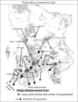
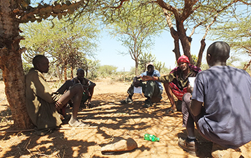
This semi-arid rangelands of Laikipia County, Central Kenya, are the location of some of the most important wildlife habitats in Kenya, being home to elephants, rhinos, lions, leopards, giraffes, buffalos and several other mega-fauna species that are an integral part of the tourist industry. The same area is also the mainstay for livestock production which is the major economic activity for local communities. Laikipia is therefore one of the biggest and most productive SEPLS in Kenya. This project assessed the spatial, temporal and seasonal uses of key natural resources in Laikipia by both wildlife and livestock production, at selected water points and along the livestock movement routes that connect these water points. The main objective was to identify the balance points between the resource needs of wildlife and pastoral communities in order to conserve the resources and reduce conflict which has often occurred because the rangelands, pastures and water points are all shared between wildlife and livestock populations.
Highlights of project results
Key achievements under the project included:
- Equitable practice of livestock production and wildlife conservation occurring in the same conservancy: This project demonstrated that biodiversity conservation can go hand-in-hand with a livestock production system.
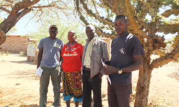
- Use of simplified technologies that can include communities in collecting information about the SEPLs where they live: The project used mobile phones for data collection based on GSM technology to develop a cost efficient and effective way to collect data, while fully involving local communities.
- Training of communities on basic principles of natural resource management for their own livelihoods, instead of externally-driven conservation objectives.
- Production of livestock, wildlife and community movement maps which will be used to advice policy development for Laikipia to enhance livelihoods, conservation and security.
Key lessons
- It is important to partner with state authorities, because they are the ones who have the resources and legal mandate in Kenya to guarantee the sustainability of positive outcomes.
- Communities must be included from the beginning when the data is being collected, because they will be willing to accept recommendations based on information that they participate in collecting. Most conservation projects in east Africa are guilty of imposing findings and recommendations on communities after the work has been completed, resulting in actions which are not socially sustainable.
- IPSI members, with the assistance of the secretariat, should have a system of sharing visits, lessons and long-term results between SDM grantees.

Related Sustainable Development Goals


Related Aichi Biodiversity Targets


Project location map
Implementing organisation